


Login or Signup
Please enter a valid mobile number
A 6-digit OTP will be shared with your mobile number
6-digit OTP will be sent to this email
OTP verification
Please enter OTP sent to (+)
Please enter OTP sent to email
Incorrect OTP
Resend OTP
Personal Details
Please Enter First Name
Please enter Last Name
Please enter Valid Email ID
Enter Valid Mobile Number
Please accept the terms and conditions
By checking this box, you agree to let us use your information
to communicate with you through E-mails, texts and calls for
providing our product or service related information for
promotional purposes. The information will be secured as per our
privacy policy.
PLEASE READ THIS ROYAL ENFIELD MOBILE APPLICATION END-USER LICENSE AGREEMENT (HEREINAFTER REFERRED TO AS “EULA”) CAREFULLY BEFORE REGISTERING OR USING “ROYAL ENFIELD” MOBILE APPLICATION SERVICES.
This EULA forms a binding legal agreement between you (“You” or
“Your”) and Eicher Motors Limited, known by its brand name Royal
Enfield (each separately a “Party” and collectively the “Parties”)
as of the date You download the Mobile App (defined hereinafter).
This EULA shall apply to Your use of the Royal Enfield mobile
application and services (“Mobile App”) provided by Eicher Motors
Limited (hereinafter referred to as “EML”, “Royal Enfield” or
“RE”).
This EULA forms a binding legal agreement between you (“You” or
“Your”) and Eicher Motors Limited, known by its brand name Royal
Enfield (each separately a “Party” and collectively the “Parties”)
as of the date You download the Mobile App (defined hereinafter).
This EULA shall apply to Your use of the Royal Enfield mobile
application and services (“Mobile App”) provided by Eicher Motors
Limited (hereinafter referred to as “EML”, “Royal Enfield” or
“RE”). This EULA only This EULA forms a binding legal agreement
between you (“You” or “Your”) and Eicher Motors Limited, known by
its brand name Royal Enfield (each separately a “Party” and
collectively the “Parties”) as of the date You download the Mobile
App (defined hereinafter). This EULA shall apply to Your use of
the Royal Enfield mobile application and services (“Mobile App”)
provided by Eicher Motors Limited (hereinafter referred to as
“EML”, “Royal Enfield” or “RE”). This EULA only This EULA forms a
binding legal agreement between you (“You” or “Your”) and Eicher
Motors Limited, known by its brand name Royal Enfield (each
separately a “Party” and collectively the “Parties”) as of the
date You download the Mobile App (defined hereinafter). This EULA
shall apply to Your use of the Royal Enfield mobile application
and services (“Mobile App”) provided by Eicher Motors Limited
(hereinafter referred to as “EML”, “Royal Enfield” or “RE”). This
EULA only
User not found
Your Country has been changed to
Select Country
Global
Asia Pacific


Europe


Americas
Middle East & Africa


Your Country has been changed to Canada


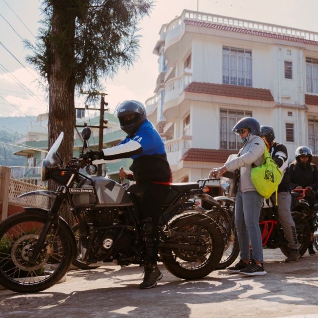
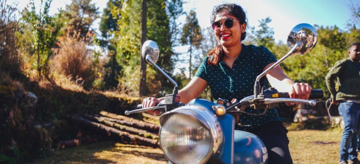
Overview
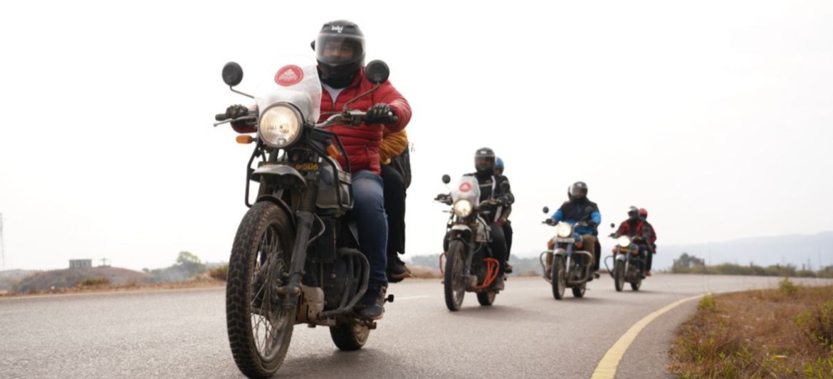
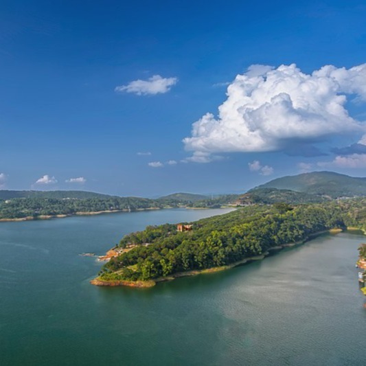
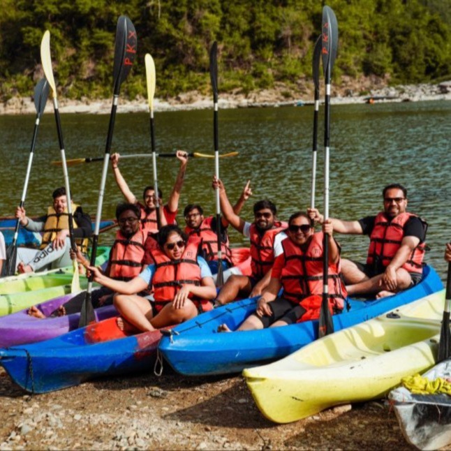
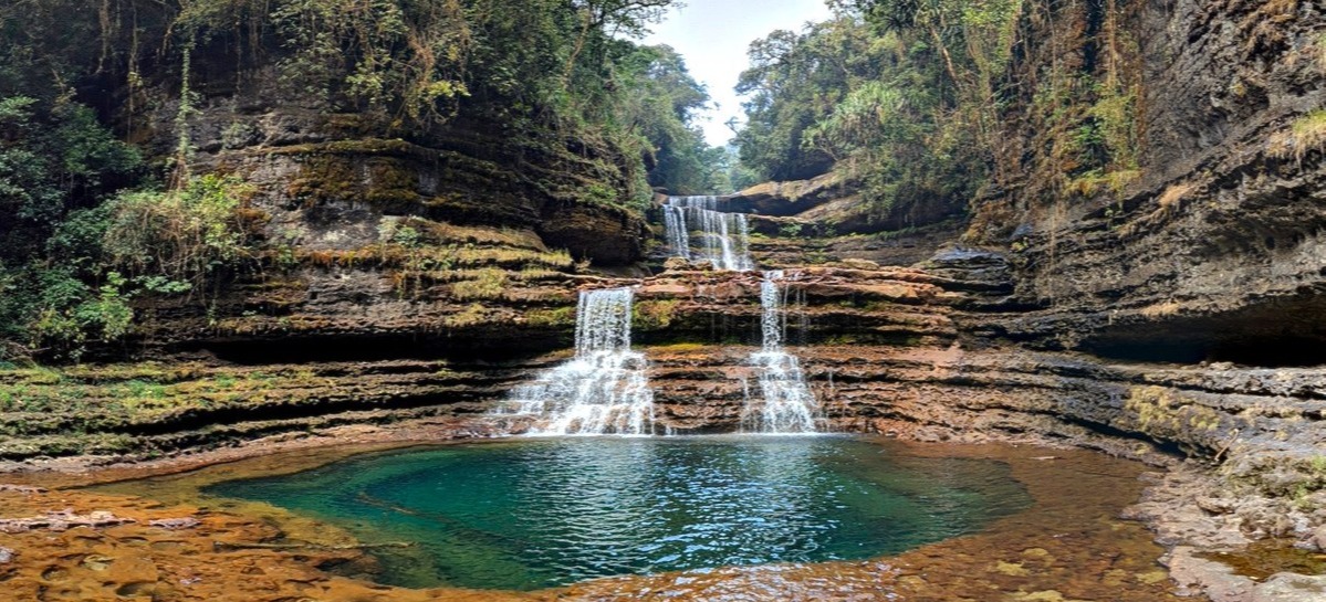
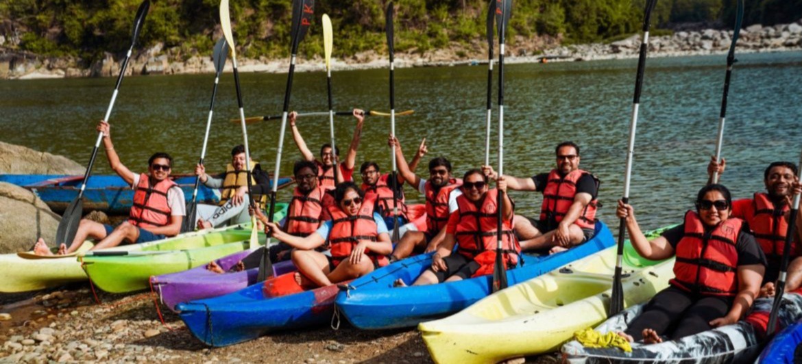
Experience the Khasi hills full of hypnotizing waterfalls, ancient caves and lush greenery Trek to the spectacular waterfalls - Wei Sawdong, Phe Phe & Krang Suri • Camp at Shnongpedeng, at the Umgot river beach (Dawki) with bonfire and music
Itinerary
Start Early
Welcome onboard traveller of Meghalaya. Reach Guwahati the Airport by 1:00 noon for the group pick up. We will glide through the plains of Guwahati to the Khasi hills and head to Shillong.We will make a stop just before Shillong to gaze at Umium Lake. Aft
Map
Start Early
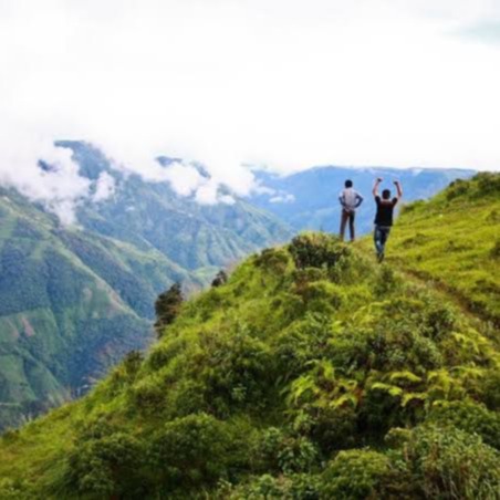
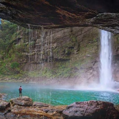
After breakfast, we will head out to Paradise in Khasi hills. At first, we will visit the grand canyon of India -Laitlum. After this, trek down for 25 minutes to the beautiful three-layered Waterfall. The blue waters of Wei Sawdong are beyond words.
Map
Start Early
Start early after the basic breakfast, and directly proceed to Tyrna Village. The trek is about 5-6 hours involving a 15-minute drive to the start point. From Tyrna village, walk down theg r e e n hills with a beautiful viewof the valley through three Kha
Map
Start Early
After breakfast, we leave for the Jayantia hills and the transparent river - Umgot (Dawki village). On the way, enjoy the beauty of the Mawkdok viewpoint. You will continue to travel toward the Indo- Bangladesh border. The roads to Dawki are no less than
Map
Start Early
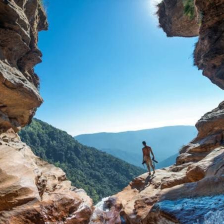
After breakfast, we will explore further deeper into Jayantia hills. Walk on the slippery trek to reach the stunning waterfall - Krangsuri falls. Stand speechless and spend the time staring at the beautiful fall with lush greenery around. After the lunch
Map
Start Early
After a sumptuous breakfast, check out early from the hotel. To control the anxiety of missing a flight, book a flight which takes off after 4 PM (You may stay &book the next day's flight and stay additionally at Guwahati too). Our vehicle will drop you a
Map
Highlights
Tour Guide

SHAMIM S
Tour Guide
Language Spoken
Hindi,English
Experience
6 Years
Keep in Mind
- RIDING GEAR TRAVEL NECESSITIES WARM CLOTHES
- Woollen gloves
- Big Bag
- MOTORCYCLE DOCUMENTS PERSONAL CARE GOODS SUFFICIENT OUTFITS & FOOTWEAR
- Inhalers
-

Nearest Railway Station
GUWAHATI RAILWAY STATION -
Nearest Airport
GUWAHATI AIRPORT
- MOTORCYCLE RC INSURANCE RIDING LICENSE
- Personal I.D.
- Travel Insurance
- First aid kit
- Breakfast
- Accommodation
- Mechanic
- Mechanic Labour Cost
- Airport/StationTransfer
- Transfer and Sightseeing
- Assistance on arrival
- Alcoholic beverages
- Lunch
- Dinner
- Medical/Travel insurance
Operated By:
Starting From
INR 33,000
*Price is subject to change.
Rentals Fleet
Reviews

Dron Bainsla
Reviewed
We all really enjoyed during the trip. Thanks to the tour guide for this wonderful experience.
Shivansh Bhardwaj
Reviewed
Great tour


Get Operator Details
Enter First Name
Please enter a valid first name.
Enter Last Name
Please enter a valid last name.
Enter Mobile Number
Please enter a valid mobile number.
Please enter a valid email id.
Please enter a valid email id.
I have fully read, understood and agree with the User Agreement / Terms and Conditions of Use for the Platform. I fully understand and agree that Royal Enfield is acting only as an aggregator and shall in no way be responsible for loss / damages or injury arising out of services / deficiency in services offered by the third party Tour / Rental Partner(s) on the Platform. Further, I hereby expressly authorize Royal Enfield to share my Personal Information with the end third party Tour / Rental Partner whose services I have chosen.
I accept all the Terms & Conditions
Please select the terms and conditions.
